
Cleburne Previous Residents by Era
Different sources answer different parts of an address history. The current Johnson CAD parcel establishes the physical location and legal description. The County Clerk's official-records index and older deed books follow ownership transfers. City and telephone volumes can supply dated household or subscriber clues. Newspapers, released census schedules, and the 1910 Sanborn set help test whether the same property and family are being followed. The web index does not state its oldest online year, so older work needs the courthouse, a request, or reel research.
| Source | Years It Covers | Where Held | What It Shows |
|---|---|---|---|
| Johnson Official Records Search | Current web index; oldest online year not stated | Johnson County Clerk web portal and public terminals | Recorded deed-search metadata and available record material |
| Johnson deed books and direct/reverse indexes | Deed books 1853-1911; indexes 1854-1903 | Texas State Library guide and UTA microfilm | Transfers, legal descriptions, and grantor/grantee links |
| Named Cleburne city directories | 1900-1901, volume 2; 1907 | Texas Tech Southwest Collection | Alphabetical resident and business entries |
| Cleburne telephone directories | 1908-1933 selected years; 1952-2005 with gaps | UT Austin Center for American History | Subscriber, telephone, business, and address clues |
| Cleburne newspapers | Digitized 1918-1990; other runs on microfilm | Library, Layland, and UNT | Notices, obituaries, sales, civic activity, and street references |
| Federal census | Released decennial schedules; local material from 1860 onward | National Archives channels and libraries | Dated household composition and occupation |
| Sanborn fire-insurance maps | 1910, 33 sheets | Library of Congress and UNT map collections | Building, lot, street, and block context |
Begin with the source nearest the time period. A recent change generally starts with the current parcel and recorder index. An early twentieth-century question may start with the named directory volumes and then use the deed reels to test the lot or legal description.
Cleburne Parcel Before Previous Residents
Use Johnson CAD Property Search to locate the current parcel by address, owner, property ID, or an advanced field. When a full address fails, JCAD advises simplifying to the street name. Write down the account or geographic ID, owner spelling, physical property location, and legal description. The latter is the important bridge to older records because many deeds use subdivision, lot, block, abstract, or survey language instead of a modern house number.
Keep three concepts separate. The situs or property location is where the parcel sits. A mailing address is where correspondence is sent. The legal description identifies the land in the recorded system. A current owner field is not proof that a person occupies the address. It is the starting point for a records trail, not a household roster.
The city and county map tools can help visualize the parcel, but Cleburne warns that GIS boundaries are approximate and are not surveys or legal descriptions. If a street form does not match the deed, compare the legal description, subdivision, plat, and adjacent parcels.
Cleburne Previous Residents Through Deeds
The Johnson County Official Records Search has Quick and Advanced modes, a search term, recorded-date controls, and index-only or index-and-full-text OCR choices. Search the current owner as grantee, narrow the date range when possible, and compare the legal description before accepting a match. The portal supports grantor, grantee, subdivision, document type, and document-number work. Its online display is not the official repository and may contain redactions or incomplete material.
- Pull the current parcel from JCAD and copy its legal description exactly, including lot, block, subdivision, abstract, or survey language.
- Find the current owner's acquisition deed in the clerk index, using the owner as grantee and checking the property description.
- Record the seller, or grantor, the recording date, instrument or volume reference, and every matching property term.
- Search that seller as grantee to find the earlier acquisition, then repeat one transfer at a time.
- When online results stop, use the Historic Courthouse terminal or request a specific record from the County Clerk with the parties, approximate date, legal description, and volume or instrument reference.
- Grantor
- The person or entity transferring an interest in a recorded instrument.
- Grantee
- The person or entity receiving that interest. In a backward deed search, the prior seller is searched as a grantee for an earlier acquisition.
- Chain of title
- The sequence of recorded transfers connected by the same legal description, not merely a sequence of similar street addresses.
- Legal description
- The lot, block, subdivision, abstract, survey, or metes-and-bounds wording that identifies land in county records.
County staff can explain the index and process a focused copy request. They do not perform a title, restriction, or foreclosure-lien search. The method builds a record trail and is not a title opinion.
Historic Cleburne Deed Index Reels
When the current index cannot carry the chain backward, the Texas State Library Johnson County microfilm guide is the local coverage map. It identifies direct and reverse deed-index reels 1435014 through 1435016 for 1854-1903 and deed volumes for 1853-1911. The guide also notes no deed Volume J and that Volume 86 was not filmed. Preserve the reel, volume, page, side of the index, and any negative result.
The microfilm guide shown below is the source for the historic reel sequence and its documented gaps.
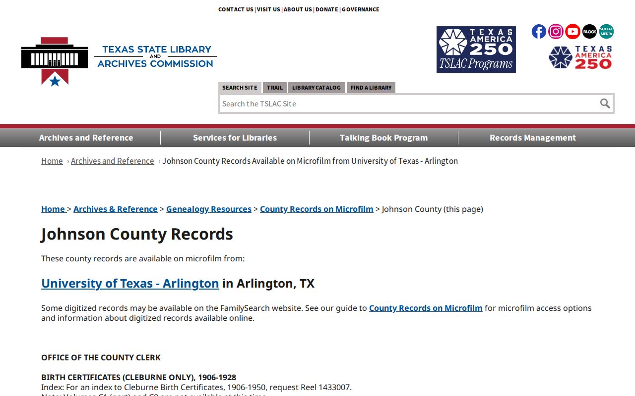
This dated index window matters because the direct index follows grantees and the reverse index follows grantors. Check both directions when an address is absent or a name appears in more than one transfer.
The County Clerk's real-property copy procedure asks for document type, full grantor and grantee names, approximate date, legal description, and volume/page or instrument number. That request format is useful after the searcher has established a specific candidate record.
1910 Cleburne Maps for Previous Residents
The 1910 Cleburne Sanborn map set has 33 public-domain sheets. It can show a building footprint, street layout, lot context, and fire-risk detail for that year. It is not a list of people. Pair the exact sheet and date with a directory, deed legal description, or newspaper item before connecting a building to a household.
Sanborn material is especially helpful when an old address has changed form. A route, lot and block, historic street spelling, or earlier ZIP can be compared with the map, a plat, and nearby parcels. The research located a 2002 postal realignment, but not an official Cleburne street-renumbering schedule. Mark an unproven connection as a break instead of supplying a presumed resident.
Cleburne Previous Residents in Directories
The household layer begins after the parcel and deed chain have identified the property. Texas Tech identifies Cleburne city-directory volumes for 1900-1901 and 1907. UT Austin records Cleburne telephone directories for 1908, 1918, 1921, 1924, 1927, 1930, 1933, and later runs from 1952 through 2005 with gaps. Use the exact available year rather than treating the sequence as continuous. A subscriber or directory entry is a dated clue, not proof of every person then at the address.
Directory entries may list a name, initials, spouse notation, address, telephone, business, or occupation. Search a named person alphabetically, capture the printed address, then inspect an address section only if that particular volume provides one. The collections themselves, their repositories, and their access limits are detailed in the Cleburne city directory material.
Note: Save the volume title, year, page, and spelling because a telephone book can include nearby communities as well as Cleburne.
Cleburne Households Between Census Years
Federal census schedules become public under the 72-year rule, and Cleburne or Johnson County pairings are available from 1860 onward. They offer household composition and occupation at a particular time, while a directory gives a nearer year and street clue. Boundaries, precinct names, and the city-county label changed as Cleburne grew, so raw address text should not be treated as a permanent identifier.
- Place the directory or telephone entry on a short timeline with the nearest released census.
- Compare surname form, initials, household members, street or route wording, and any occupation or business clue.
- Test a changed address against the legal description, Sanborn sheet, plat, or a newspaper notice.
- Search the next directory year and the next released census rather than assuming the family remained in place.
Cleburne's railroad expansion is useful local context for this work. Santa Fe central machine shops opened in 1898-1899, and city population rose from 7,493 in 1900 to 12,820 in 1920. A company or shop term printed in a directory can be searched in newspapers and census material, but it should never be added to a person's history unless the source actually shows it.
Cleburne Previous Residents and Endpoints
Obituaries, probate papers, cemetery records, and newspaper sale notices can close or redirect a Cleburne address trail. A probate filing may identify heirs, fiduciaries, or notice addresses. A cemetery record can support a burial date, but not necessarily a final residence. A sale notice can connect a person to a property date, yet it may describe a trustee sale rather than a voluntary transfer. Record the source type and the limited fact it establishes.
The Cleburne Public Library's digitization project supports newspaper searching across 1918-1990, although undigitized microfilm and OCR errors remain. The city has four historic cemeteries, and Chambers Cemetery presents a significant records gap because the city received no sales records, deed records, maps, or ledgers when it acquired the site in 1964. That absence is a reason to combine headstones, newspapers, family papers, GIS, and oral history, not to infer a missing event.
Lawful use. Cleburne previous-resident research is appropriate for family history, estate matters, house history, and personal curiosity. Do not use an address or record trail to track, stalk, harass, or harm a living person.
1912 Cleburne Records Gaps
The April 15, 1912 fire that destroyed the Johnson County Courthouse killed Marshal Marion Abe Bledsoe as he assisted firefighters. The courthouse now standing was completed in 1913. The event is a reminder to verify survival of a particular volume through the county, Texas State Library microfilm guide, UTA, or an archive. It does not establish that every Johnson County record disappeared.
Other documented gaps matter too. Marriage records from 1854-1860 were reported stolen, and some deed, court, and probate material is missing or irregular on microfilm. A sound Cleburne previous residents chronology records the exact search terms, record date, repository, and unbridged break. Verification with the custodian is the right next step when the trail conflicts.